
SOUTH AMERICA
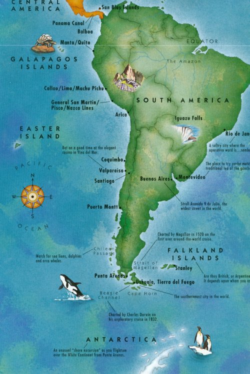 |
|
South America |
 |
|
Ports of Call |
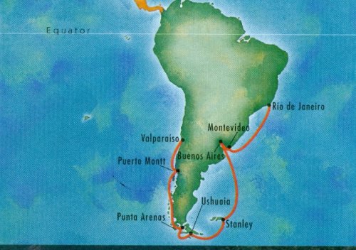
We embarked our ship, the Noordam at Rio De Janeiro in 2000 and prepared for our trip around the tip of South America. Some 481 years earlier, in September, 1519, Ferdinand Magellan, a man of power and deep dedication, set sail with two hundred and seventy-seven men and five naos - the San Antonio, the Trinidad, the Victoria, the Cancepcion, and the Santiago to make the same voyage, but these men were at the mercy of the winds. The difference: he was attempting to do it for the first time, for no other person had ever done it before.
 |
|
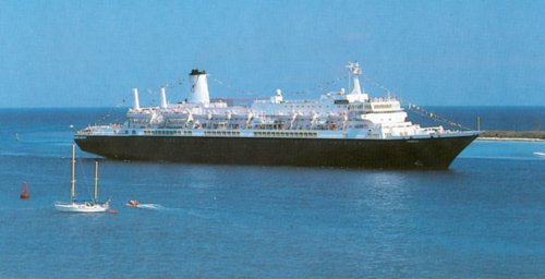
Our Ship, the 34,000-ton Noordam |
 |
|
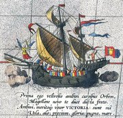
One of Magellan's naos, the 90-ton Victoria |
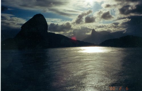
We began our cruise in Rio de Janeiro, which Portuguese navigators first sighted on January 1, 1502. They thought the entrance to its bay was a huge river, hence the name, Rio de Janeiro. On 13 December, 1519, Magellan arrived there. The crew careened and reprovisioned their vessels among other things. They thought this anchorage the most beautiful in the world.
When we sailed into lovely Guanabara Bay, we shared their opinion. Its setting was spectacular and a highlight of the cruise. The sparkling waterfront area still attracts hordes of tourists to see its fantastic features, which include Sugar Loaf Mountain and Botafogo Beach, both enhanced by the beautiful blue of the sea and the emerald green of forests abloom with flowers.
 |
|
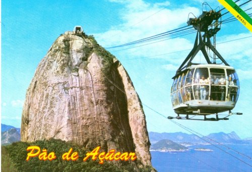
Sugar Loaf Mountain at the entrance to the bay |
From a location called Red Beach, we boarded the first section of the cable car to Urca Mountain. From there we boarded a second section of the aerial car for the ride over to Sugar Loaf itself. The landing area at the top was tiny and tight, but the panoramic views of this beautiful city were superb.
 |
|
Cable car |
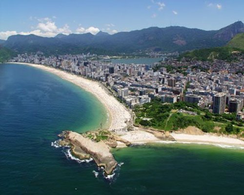
Beaches, all of which are public, are integral to the life of the city. They were packed with people. Volleyball nets lined both Copacabana and Ipanema and all were in use. While the city sights were colourful and captivating, tourists were told to take care. Warnings were issued to those wanting to walk around. They were told to dress down, for muggers watched for money. Copacabana was especially notorious for the disappearnce of unattended items.
 |
|
Rio's Beaches |
 |
|
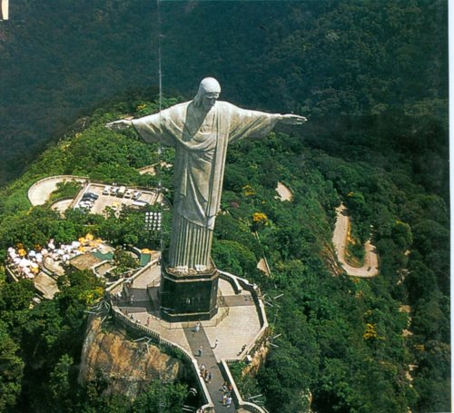
Rio de Janeiro's Statue of Christ the Redeemer ('Cristo Redentor') |
This very impressive statue embracing all of Rio, has been named one of the New Seven Wonders of the World.It stands 38 metres (120 ft) tall weighs 700 short tons (635 tonnes), and is located at the peak of the 700 metres (2,300 ft) Corcovado mountain overlooking Rio de Janeiro. It is the tallest of its kind in the world and is made of reinforced concrete and soapstone.
 |
|
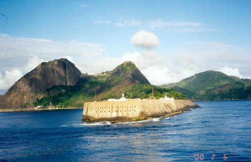
Fortress in Rio's Harbour |
Bearing SW and bound for Montevideo, the Noordam made the 1826 km/1135 mi. in 15 hours. Magellan's ships left Rio bay with a light heart on Christmas morning, the local Guarani natives in hot pursuit, all the while beseeching their valued visitors to stay. Our departure was less lamented by the samba citizens of carnival town, who never noticed we had left.
Magellan's naossplit up. Magellan sailed south in search of Terra Australis. which was indicated on their maps as being only a few miles beyond the tip of South America. Several other vessels sailed westward into el paso. Their reunion a week or so later was a gloomy one, for Magellan had found no sign of Terra Australis, and the others had found not a strait, but rather a river - the Rio della Plata. Uruguay's capital received its name, when one of lookouts peering throught the mists, suddenly shouted out, " I see a mountain." hence - Montevideo.
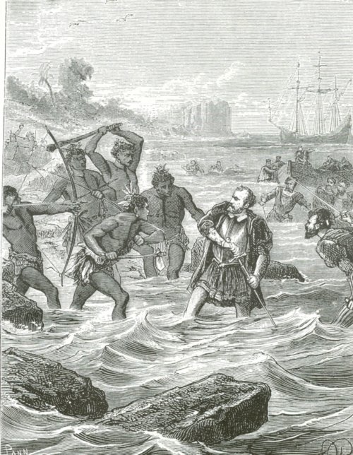
Despite murmurings of mutiny among some of the crew, Magellan refused to make for the Spice Islands by sailing east. Insisting they continue south, he led off, often piloting the Trinidad. himself. Initially, making about 100 miles a day, Magellan picked his path carefully through uncharted reefs, sandbars and shoals, for he always kept his vessels as close as possible to shore. As they progressed, a headwind arose so strong and boisterous, that at times, the naos were literally driven backwards. They persevered for some time, however, finally being faced with mountainous seas, gale-force winds and a crew that had reached the limit of their endurance, Magellan agreed to stop. He was urged to return to the estuary of the Plate, but chose instead to drop anchor in a place called Puerto San Julián, known historically as Port St Julian, a natural harbour in Patagonia, which is located in the Santa Cruz Province of Argentina.
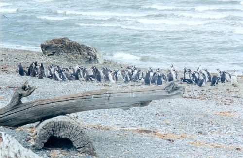
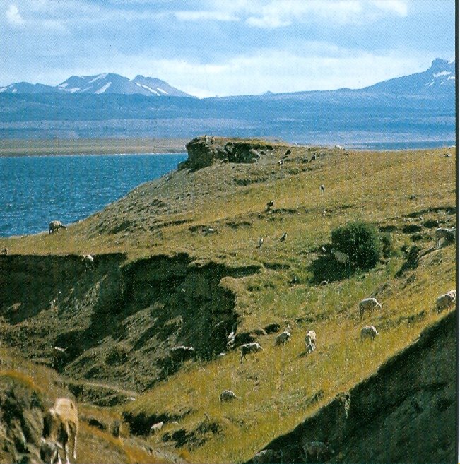
They were to spend five weary months here in the presence of people whom they considered to be giants. The name Patagonia comes from the word patagón meaning big foot, and was used by Magellan to describe these giant native people. It is now believed the Patagons were actually Tehuelches (a native tribe of Patagonia) who had an average height of 1.80 m ("5'11") compared to the 1.55 m ("5'1") average for Spaniards of the time., As well as their humungus hosts, there were strange, strutting animals about, "the like of which no Christian man had e'er set eyes on." These bizarre beasts inhabiting the uttermost ends of the earth were penquins.
 |
|
Penquin Colony |
Meanwhile, we reached Montevideo. Uruguay's capital.
 |
|
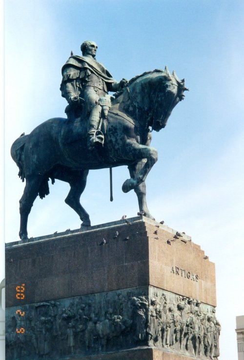
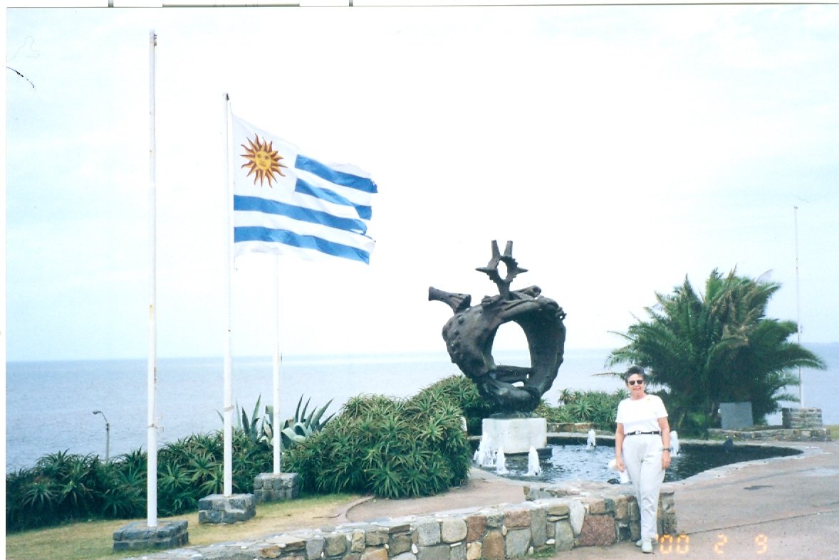
Monument of Artigos |
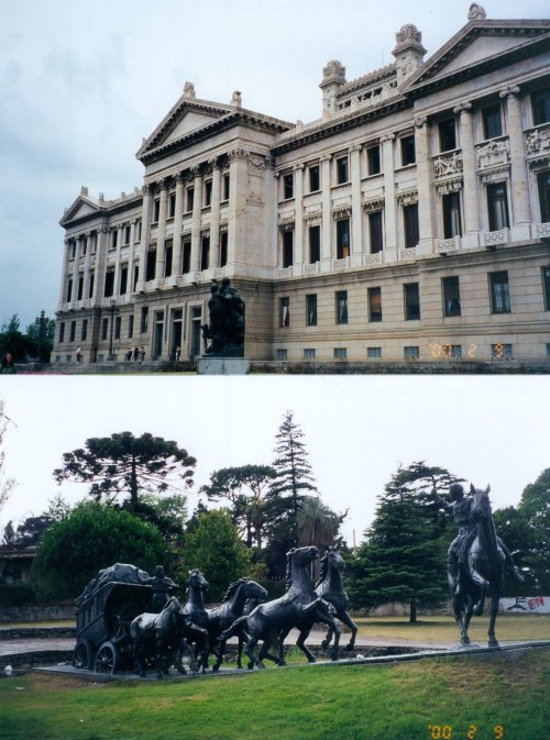
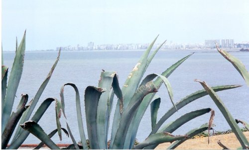
Uruguay is, one of the smallest countries in South America. Slightly larger than England and Wales combined, it has a population of just over three million people, most of whom are of Spanish or Italian origin. With the aid of a pilot, we entered Rio de la Plata, a wide but very shallow river, with Montevideo on the Uruguayan side and Buenos Aires on the Argentina side. Founded in 1726, Montevideo is the largest city with half the country's population. Comprised of the Old City and the New City, the former has narrow streets, large plazas and elegant colonial architecture. The latter is the commercial and entertainment centre. The Legisative Palace is an ornate, marble structure considered to be one of the three most beautiful legislative buildings in the world.
 |
|
Top: Uruguay's Legislative Palace |
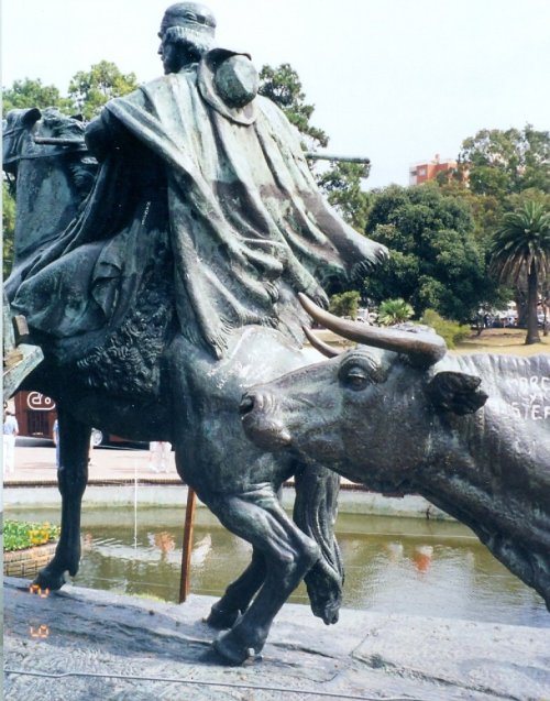
In the great wide plains areas of Uruguay called pampas, cattle raising is a primary way of life. Wherever you have cattle and cattle ranches, you have people on horseback tending to them. These men are called gauchos, from the Quechua huachu, which means orphan or vagabond.
 |
|
Monument to the Gaucho |
 |
|
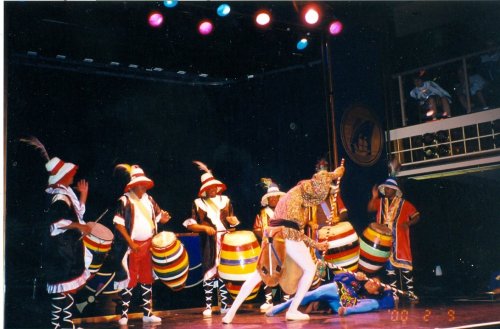
Uruguayan Folklore show |
Rio de la Plata (Plate River) is a wide estuary on the Atlantic coast of South America at the border between Uruguay and Argentina. Formed by the confluence of the Rivers Parana and Uruguay, the cities of Buenos Aires and Montevideo lie on its shores.
 |
|
Rio de la Plata |
 |
|
Monument |
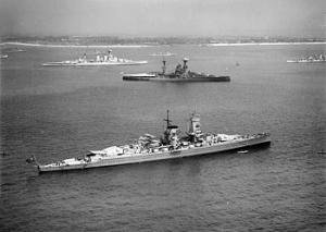
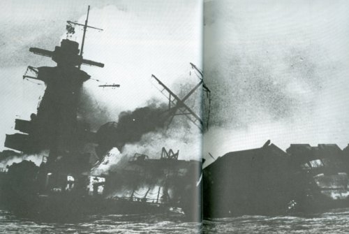
Rio de la Plata was the site of the Battle of the River Plate, when the German 'pocket battleship' Admiral Graf Spee was "run to earth" here in December, 1939. Pursued and pummelled by Ajax, Achilles and Exeter, Spee's Captain Langsdorff broke off action and headed for neutral Uruguayan waters to repair his ship's damage. Intense British diplomatic pressure was applied to persuade Uruguayan authorities not to intern her. A war of nerves followed. Finally Hitler's broke and he ordered Langsdorff to scuttle his ship rather than risk her capture or internment. On the afternoon of 17 December, the Spee transferred more than 700 men to a German merchant vessel in the harbour and weighed anchor. At 6:15 p.m, watched by immense crowds, the badly damaged Graf Spee left the harbour and steamed seaward. In Uruguayan waters some six miles south west of Montevideao harbour, explosions occurred. At 8:54 p.m. an aircraft from the Ajax reported, "Graf Spee has blown herself up." The badly shaken Langsdorff shot himself that night.
 |
|
Admiral Graf Spee |
 |
|
Admiral Graf Spee Scuttled off Montevideo |
Prime Minister Winston Churchill had this to say about the looming leftovers of the wrecked warship. "The Graf Spee still sticks up in the harbour of Montevideo as a grisly monument and as a measure of the fate in store for any Nazi warship which dabbles in piracy in the broad waters."
 |
|
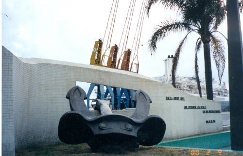
Anchor |
 |
|
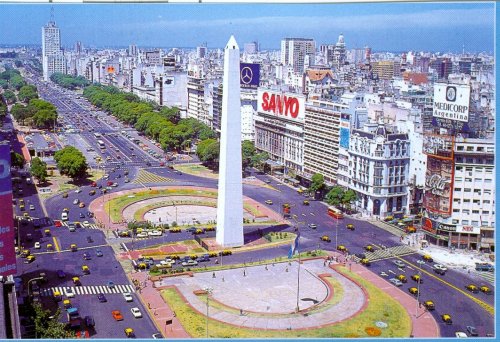
Avenida 9 de Julio |
 |
|
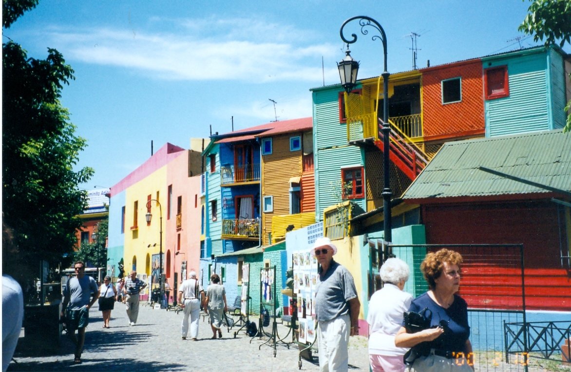
La Boca |
 |
|
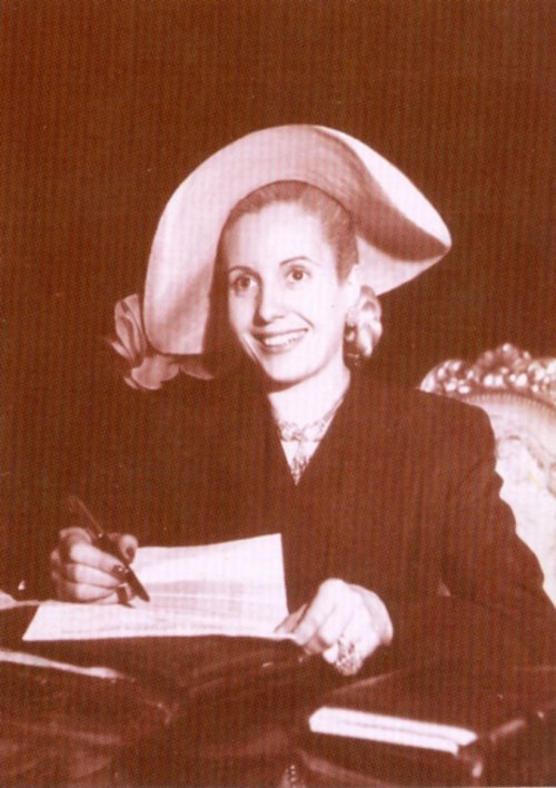
Don't Cry For Me Argentina! |
 |
|
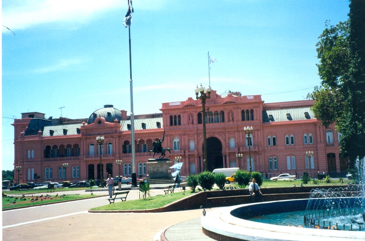
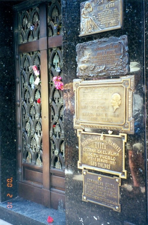
Juan and Eva Peron Used to Greet Argentinian Crowds from a Balcony in this Building in Mayo Square.. |
From this government building in Mayo Square, Buenos Aires, Eva and Juan Peron waved at and occasionally spoke to the throngs crowding the square to hear them.
 |
|
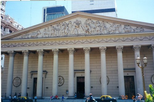
Cathedral of St. Martin |
 |
|
Eva's Tomb |
The Madres de Mayo at the Plaza de Mayo, activists in the Asociación Madres de Plaza de Mayo, have been working tirelessly in Argentina for three decades to find out what happened to their sons and daughters who were "disappeared" by the 1976-1983 military dictatorship. Internationally renowned for their work in defence of human rights, the Madres (mothers) have branched out in their activities.
Last year, the Madres undertook the mission of building decent housing in slum neighbourhoods, known in Argentina as villas miserias. They are there in the Plaza every Thursday, wearing their white scarf on the heads, asking the government to do something about their missing relatives, usually their sons or daughters. During the military regime in the 70's, lots of young people "disappeared" because their political views were not like the government views. The military accused them of being communists and killed most of them. However, the bodies never appeared and these mothers go every week to protest silently this savagery. They usually carry photos of the missing people, so that no one forgets who was killed.
 |
|
White Scarf: Symbol of Searching Mothers |
Our next port of call was supposed to be the Falkland Islands, however, word was received that weather and waves would not permit us to land on that island. We began to worry that the same tossing tempests could be expected for our trip around the part of the globe well known for its bludgeoning winds, wild waves and driving rain. Worries about the weather must have weighed heavily on Magellan and his men too, as their tiny ships were tossed about by waves made wild by the seemingly ever-present winds.
Magellan had cause for even more misgivings about the remainder of their mission, for in addtion to the threat of heavy weather, he sensed that mutiny now occupied the minds of many of the men. Faced with their fears, the Captain-General acted. Not a man to be trifled with, Magellan waged war against his own crews to compel them to continue. One ship was shattered on a reef. A lesser leader might have abandoned all and sailed east, but not Magellan. At a conference he called of captains, pilots, officers and representatives of the crew, all urged him to give up the search for a way west. It is recorded that he thanked them for their advice and stated bluntly, "We shall search for el paso until we find it." His dream became their nightmare.
On 18 October they were once again at sea sailing south along coasts that grew increasingly desolate, Upon reaching a beautiful horseshoe bay, a sudden and very violent storm separated the ships. The San Antonio and the Concepcion were swept helplessly beyond a dagger-like promontory and disappeared into the breakers' mist. The Trinidad and the Victoria escaped the worst of the shoals by heading into the centre of the lake. Having already lost one ship, Magellan must have been close to despair at the thoughts of losing two more. Several days later, the storm subsided and Magellan's two naos rounded the promontary to search for the missing vessels. There before them lay a deep-water ed stretching away into the distance. A lookout then cried, "Two sail approaching fast." It was the San Antonio and the Concepcion, both bedecked with pennants and flags flying. They had discovered el paso, and on 28 November, Magellan and what remained of his fleet finally entered the Straits that bear Magellan's name.
 |
|
Strait of Magellan |
The strait meandered past towering cliffs and through a maze of islands and ice floes. On one side loomed the snow-capped peaks of Tierra del Fuego, shrouded in a hazy mist. The following was recorded about the strait. "We found by miracle a strait. This strait issues into the Pacific Sea. It is surrounded by very great and high mountains covered with snow. I think there is not in the world, a more beautiful country, or a better strait than this one."
The waters of the strait are entirely Chilean. Two-thirds of the Tierra del Fuego archipelago belong to Chile, the remaining one-third to Argentine. Promontories, reefs, and ice-blue glaciers lead on to Cape Horn, beyond which lies Antarctica and the end of the world. The four naos took thirty-eight days to sail the 585 km-passage from sea to sea.
Magellan was killed in a battle in the Phillipines on 27 April, 1521, His body was not recovered. And so, lamented one member of the crew, "they slew our mirror, our light, our comfort and our true and only guide." Almost exactly three years later, one ship, the Victoria, and eighteen of the 277 men who departed on the voyage, returned to Seville. They had circumnaigated the globe.
Magellan's epitaph was recorded by the same crewman in his diary. "So noble a captain ... he was more constant than anyone else in adversity. He endured hunger better than all the others, and better than any man in the world, did he understand sea charts and navigation... the best proof of his genius is that he circumnavigated the world, none having preceded him."
Ferdinand Magellan did not circumnavigate the world. He was, nevertheless, the first to realize the dream of Columbus by reaching Asia sailing west. Without his vision, tenacity and leadership, the Victoria would never have crossed the Atlantic, let alone the world.
 |
|
Death of Ferdinand Magellan |
 |
|
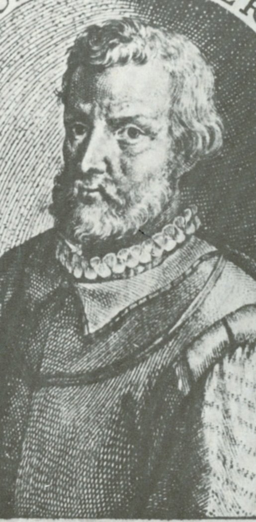
Ferdinand Magellan |
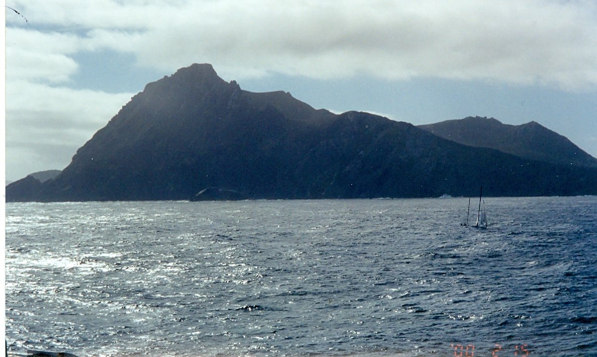
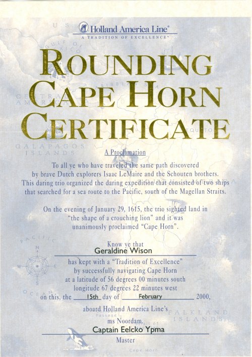
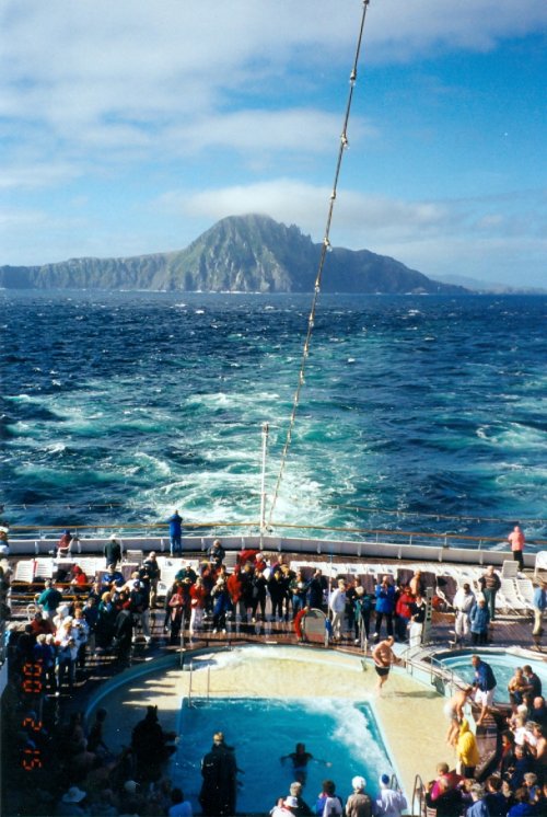
The bottom of South America is 2407 km further south than the Cape of Good Hope. Until the Panama Canal was opened, Cape Horn was the principal route from the east coast of North America to the Far East. Cape Horn is located on Islas Hornos, a rocky island 422 metres high, 7l4 kilometres long and 3.7 kilometres wide. It was sighted by the Schouten brothers of Holland in 1615. Toward evening they sighted land that to them looked "like a crouching lion," which they proclaimed, "Cape Horn" for their home port of Holland. Today Islas Hronos serves as a meteorological and radio station for the Chilean navy and is inhabited by three people.
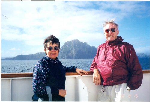
The Noordam rounded Cape Horn on Tuesday, 15 February, 2000. Much to our amazement, at the spot where two oceans meet and meld and where wild weather had caused no end of chaos, the sea was silent and serene, its surface almost glass-like. We celebrated sitting at the tip of that continent, the historic scene of untold havoc, hardship, drama and high adventure and heroic displays of determination, dedication, courage and constancy of immortal individuals like Ferdinand Magellan, Sir Francis Drake and Captain James Cook.
 |
|
Cape Horn |
 |
|
Two Tourists at Cape Horn |
 |
|
Fearless in the Face of Calm |
 |
|
Tourists Take In Cape Horn |
Copyright © 2013 Website Administrator